The Annapurna Circuit
For a map of the Annapurna Circuit please go to http://www.annapurnatrek.com/annapurna_map.html
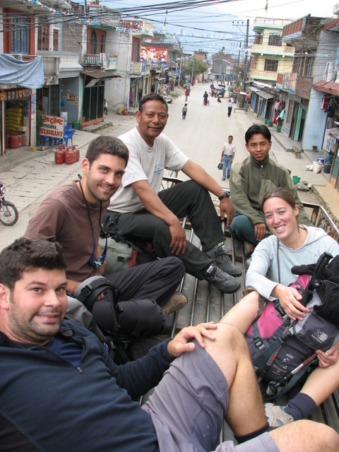
The primary reason for coming to Nepal was to do one of the multi-day mountain treks that the country is famous for. Once here, we decided that the way to go was the Annapurna Circuit. We and our newly found English friends, Clare and Darroch, decided to hire both a porter and guide for the 21 day trek. We went to meet Kaji and Laddu from the Overseas Adventure Travel company and after a short talk decided to take them on. For the next 21 days, Clare, Darroch, Laddu, Kaji and us walked over 300 km around the Annapurna Mountain range and reached heights of 5,416 meters above sea level.
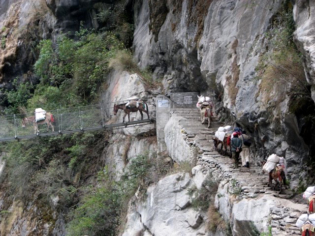
The circuit takes you through the Marsyangdi river valley, over the Thorong-La pass and through the Kali Gandaki valley which was once an ancient Tibetan trade route. There are no vehicle roads in this mountainous area. The only way to get around is by walking trail. We shared the trail with porters, mules, horses and locals who traveled between the mountain villages. Most of the products available in the villages on the trail, including the chocolate bars and Tang drink mix, have to be brought in by porters, mules or helicopter. As a result, a chocolate bar at the highest points on the trail can go for over 100 Rupees (about CAD $1.70).
The difficult access to many of the villages has ensured that they have remind untouched by most modern development. Houses are made of local stone and timber. Villagers are involved in agriculture, raising livestock (primarily goats, cows, oxen, yak and nak) and running tourist lodges. Most houses do not have running water and most cooking is done by wood fire. Electricity is sometimes available but you often have to have a candle or torch available to cope with the numerous power cuts that are both scheduled and non-scheduled.
The quietness of this area will not last for long. There are big projects underway to build a road that would provide vehicle access up to Manang on the western part of the trail and up to Muktinath on the east. While this is unfortunate for trekkers, this road may be the difference between life and death for locals requiring medical assistance who would previously have had to walk up to several days to the nearest doctor.
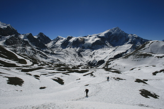
The trail is challenging, but anyone of average fitness should be able to do it. The two major concerns are weather and altitude. Thorong-La pass is one of the highest mountain passes in the world at 5416 meters. At this time of the year snow storms can make the pass too dangerous to cross. In fact, days before we set off on our trek, snow at the pass had forced many trekkers to abandon the circuit. Also, above heights of 3,000 meters some people start to feel the effects of altitude sickness such as nausea, vomiting and shortness of breath even when resting… The key is to ascend slowly and to make sure that you get acclimatized – that means spending a minimum of 2 nights at an altitude of about 3,500 meters before going any higher. It’s also important to not gain over 300 meters of altitude in one day. Thanks to a good trekking plan/route and to our experienced guide and porter, we were all healthy and strong throughout the trek.
For those interested in completing the Annapurna Circuit, here is the itinerary we followed:
Day 1: Local bus from Kathmandu to Bhulbhule
Day 2: Trek to and stay in Ghermu (near Syange)
Day 3: Trek to and stay in Tal
Day 4: Trek to and stay in Temang
Day 5: Trek to and stay in Chame
Day 6: Trek to and stay in Lower Pisang
Day 7: Take the harder but more rewarding Upper route and trek to and stay in Ghyaru
Day 8: Trek to and stay in Braga for 2 nights
Day 9: Stay in Braga and climb up to get a blessing from the 100 Rupee Lama (great for acclimatization)
Day 10: Trek to and stay in Yak Kharka
Day 11: Trek to and stay in Thorung Phedi
Day 12: Trek to and stay in Ranipawa – this is the day you go over the Pass!
Day 13: Trek to and stay in Kagbeni
Day 14: Trek to and stay in Marpha
Day 15: Trek to and stay in Kalopani
Day 16: Trek to and stay in Dana
Day 17: Trek to and stay in Tatopani
Day 18: Trek to and stay in Shika
Day 19: Trek to and stay in Ghorepani
Day 20: Trek to and stay in Tirkedhunga – if the weather is good that morning go up to Poon Hill for sunrise
Day 21: Trek to Nayapul and take a bus/taxi to Pokhara
Also, if you are in need of a guide or porter, we highly recommend Kaji and Laddu. They took care of us and we had a great time together. If you wish to get in contact with them you can email Kaji (via his daughter) at amita_shrestha65@hotmail.com or contact us and we can also give you telephone numbers where they can be reached.
The trek offers great views of the Annapurna range mountains. On the trail, you can see two of the fourteen over 8,000 meters peaks: Annapurna 1 and Dhaulagiri. The first couple of days of the trek, whenever we would see a large peak that was often snow covered, we would ask
Kaji: “Kaji, what is that mountain called?” He replied with a chuckle: “That is not a mountain. That is a hill!” When we got our first look at real mountains we finally understood.